Turning Warmer and More Humid to Begin December – WSVN 7News | Miami News, Weather, Sports
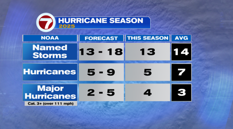
Today is the final day of November and therefore also the last day of the Atlantic hurricane season!
With 13 named storms, that ended up being 1 storm below what’s typical. Luckily for the US, no hurricanes made landfall this season. The last time that happened was 10 years ago back in 2015.

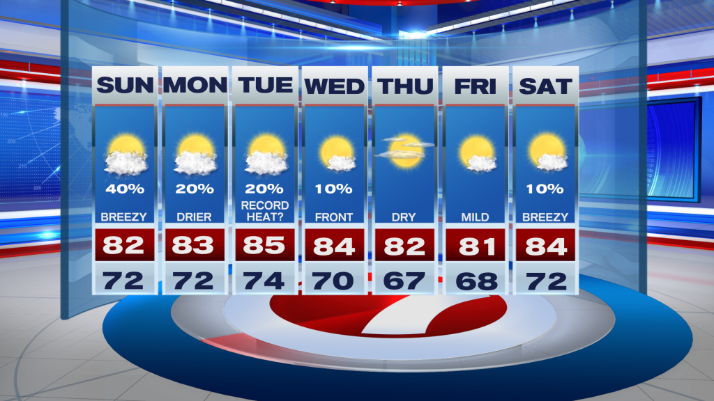
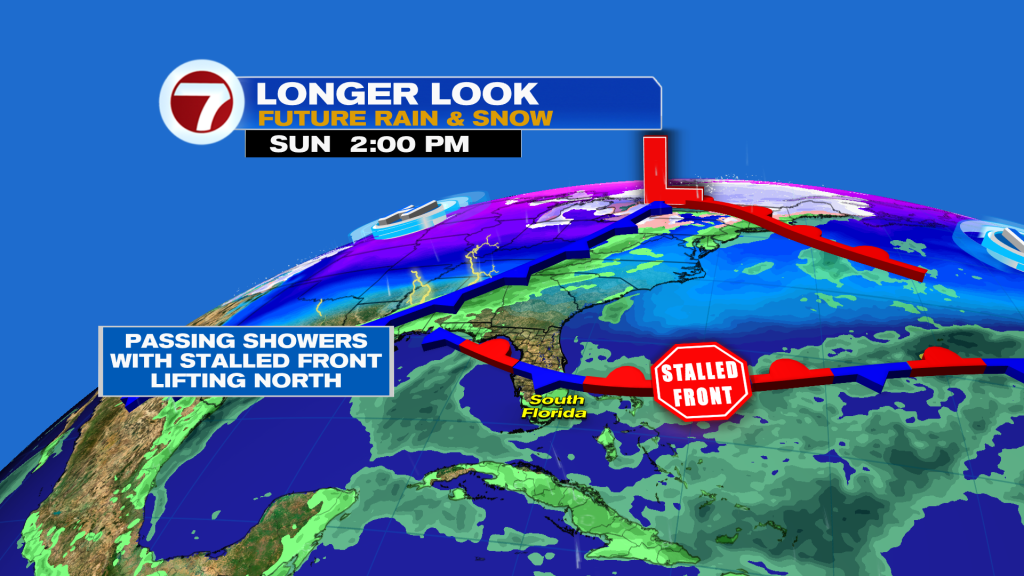
In South Florida to end the weekend, there will definitely be no hurricane concerns but it will be another breezy day. Winds won’t be as strong as they were on Saturday but gusts up to 25 mph are still expected.
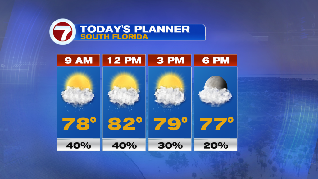
That will come with periods of cloudiness and quick-moving, passing showers, especially during the morning and midday hours. Otherwise, it will be warmer and more humid with high temperatures in the low 80s.
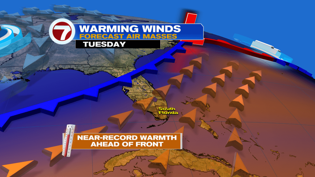
For the start of the new week — Monday into Tuesday — it will continue to turn warmer and more humid with even the potential for record heat on Tuesday with widespread highs in the mid 80s due to a southwest wind ahead of our next front.
This time frame will feature a mix of sun and clouds, a nice breeze and the chance for some spotty showers.
The aforementioned front will arrive on Wednesday and will lead to a brief, subtle change to our weather pattern with temperatures returning close to normal by Friday. Highs will mainly be at around 80F while lows will be in the mid to upper 60s.
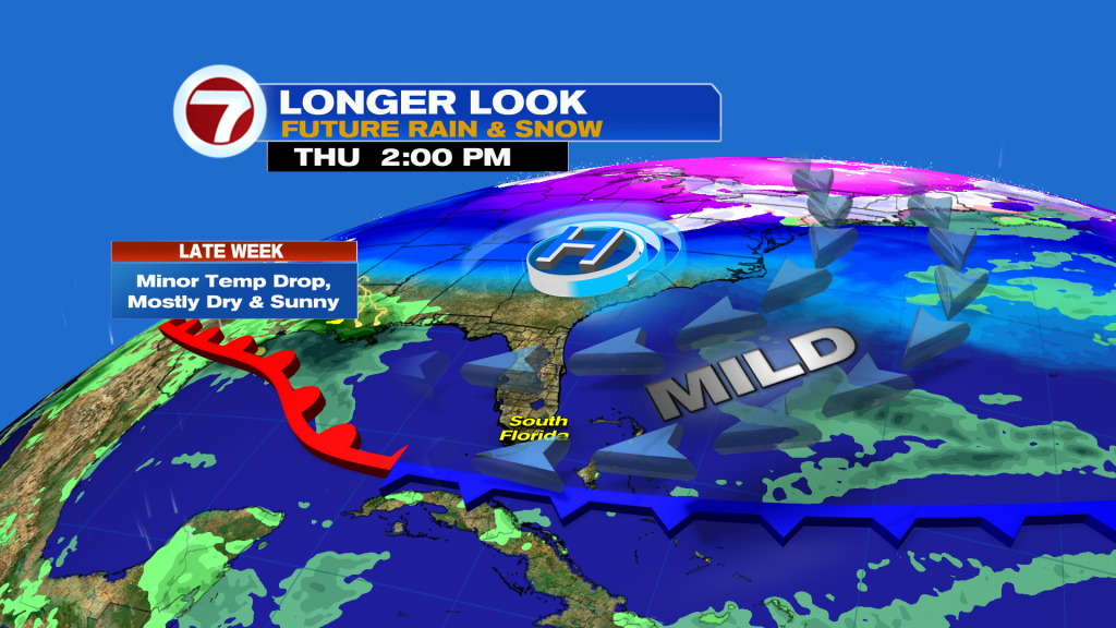
It will also feel a touch less humid before that front lifts back north, ushering in warm and humid conditions come next weekend.