
Higher Storm Chances This Weekend – WSVN 7News | Miami News, Weather, Sports
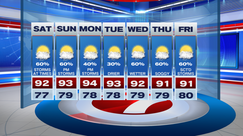
The weekend is here and the higher rain chances we dealt with during the week will stick around for Saturday and Sunday. It’s a pretty typical summertime pattern, with general westerly winds leading to a hot and dry start, and then sea-breeze storms in the afternoon. Rain chances look pretty similar for Saturday and Sunday, with around 60% coverage each day.
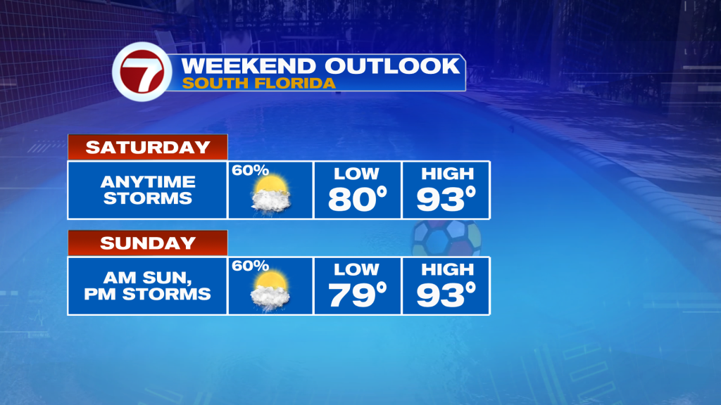
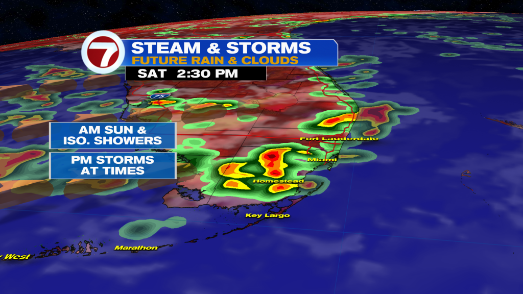
As for today, we’re looking at more clouds than sun throughout the day. Despite that, we will still manage to get in the lower 90s, with the heat index climbing into the triples. As we head later in the afternoon, showers and storms are expected to fire up inland and spread eastward towards the I-95 corridor. Heavy rain, gusty winds, and frequent lightning are the main threats.
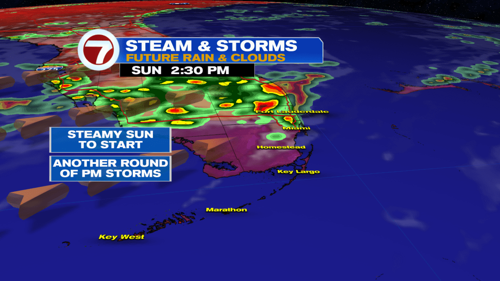
Sunday looks like a carbon copy to today. The only difference is there maybe a bit more sun in the early parts of the day to warm us up. Otherwise, that steamy sun will send our temps soaring in the 90s, and with plenty of deep tropical moisture over the area, we’re expecting another round of storms in the afternoon.
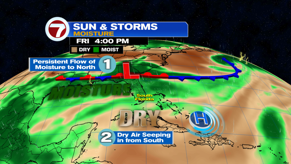
Looking at the big picture, a frontal boundary to our north will trap moisture over Florida this weekend, leading to higher rain chances. By early next week, the front falls apart and we’ll see less moisture, and thus lower rain chances across the area. By the second half of the week, another cold front will dive down, and stall to our north. This will once again lead to higher rain chances across the area.
Otherwise, we’re looking at seasonable heat and humidity this upcoming week. Expect highs in the low to mid 90s and lows in the upper 70s. The head index each day will be in the lower-triple digits, so make sure you drink lots of water and hop in the air conditioning when possible!
TROPICAL UPDATE
Erin is gone, but we’re watching two areas in the Atlantic Basin.
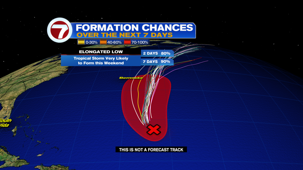
First up is Invest 90L, which has a high chance of becoming a depression or tropical storm over the weekend. The good news for us is it’s expected to follow Erin out to sea. However, Bermuda will need to keep an eye on it as it passes by late Sunday night into Monday morning, as it could bring tropical storm conditions to the area. The next name on the list is Fernand.
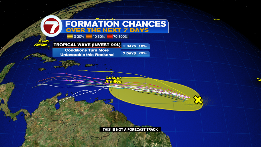
Meanwhile, Invest 99L is located in the deep tropical Atlantic between the Lesser Antilles and the Cabo Verde Islands. The tropical wave currently has a low chance of becoming a depression over the next seven days as it enters the Caribbean due to hostile conditions. However, it could bring higher rain chances and gusty winds to the Windward islands Sunday into Monday. In the long-range, it could find more favorable conditions in the Western Caribbean, so we’ll keep an eye on it but there’s nothing to worry about at this time.