Daily Dose of Showers and Storms this Week – WSVN 7News | Miami News, Weather, Sports
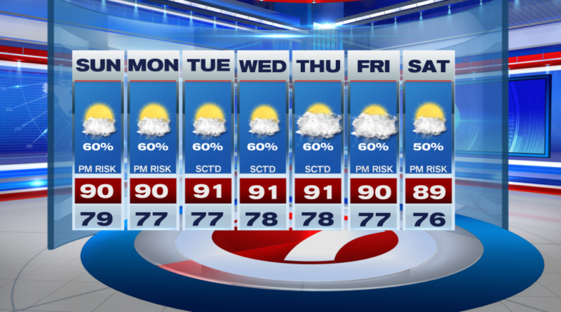
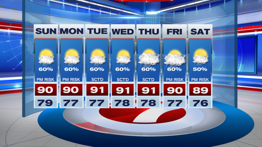
The unsettled times continue this week as we roll on through September — South Florida’s second wettest month of the year. While rain chances will hold steady at typical levels of a 50-60% these next 7 days, no washouts are currently expected. Instead, it’s that rinse and repeat pattern where we start off with some sunshine before that gives way to scattered afternoon storms.
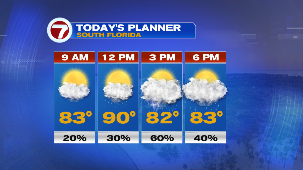
Unlike yesterday when thunderstorms near the coast robbed much of the mainland from rain and storms, today should feature a better opportunity for seeing some afternoon activity given fewer storms offshore this Sunday morning.
Therefore, expect filtered sunshine and low rain chances throughout the morning, then scattered showers and thunderstorms at times during the afternoon. Depending on the exact storm timing, high temperatures should be warmer, reaching the upper 80s to around 90F.
By tonight, conditions will turn drier besides a spotty shower chance. Clouds will decrease but thin, wispy upper clouds will still be present. That means if you’re trying to see the Full Corn Moon, it will likely be filtered out much of the night but at least the clouds should be thin enough to still see it.
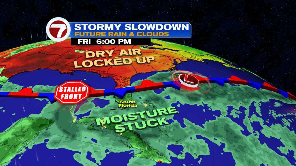
Heading into the new week, a new front will stall out across Florida. This will keep moisture trapped across the state and therefore keep those rain chances in the forecast all week long, especially during the late-morning through mid-afternoon hours. High temperatures throughout the week will hold steady near 90F, which is very typical for this time of the year.
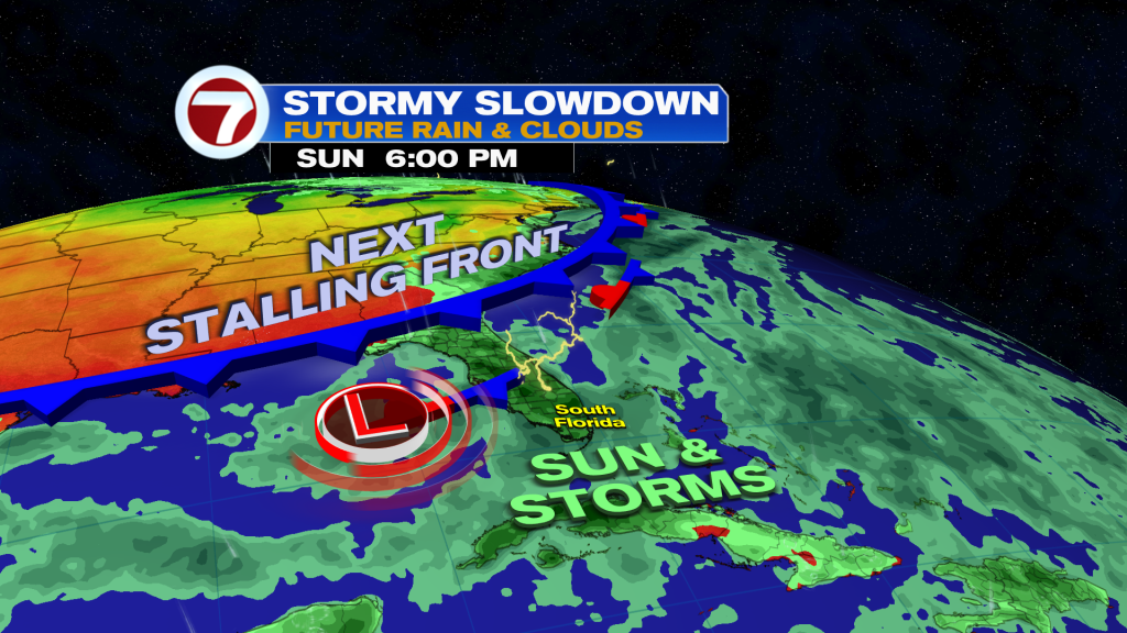
Potentially by next week, some drier air may sweep in, leading to a possible reduction in rain chances.
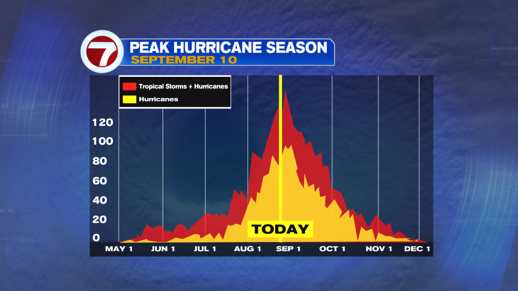
Tropical update
There are currently no areas to watch for tropical development over the next week. This is definitely unusual considering the peak of the Atlantic hurricane season is coming up in a few days on September 10.