Sun and Showers This Weekend – WSVN 7News | Miami News, Weather, Sports
It’s much of the same heading into this weekend, as we’re stuck in the same pattern that’s given us higher rain chances over the past few days. A fickle front stalled over the area will provide a focus for showers and storms across the area today, and a bit more tomorrow. Neither day will be a washout, but it’s advised that you keep the umbrella handy.
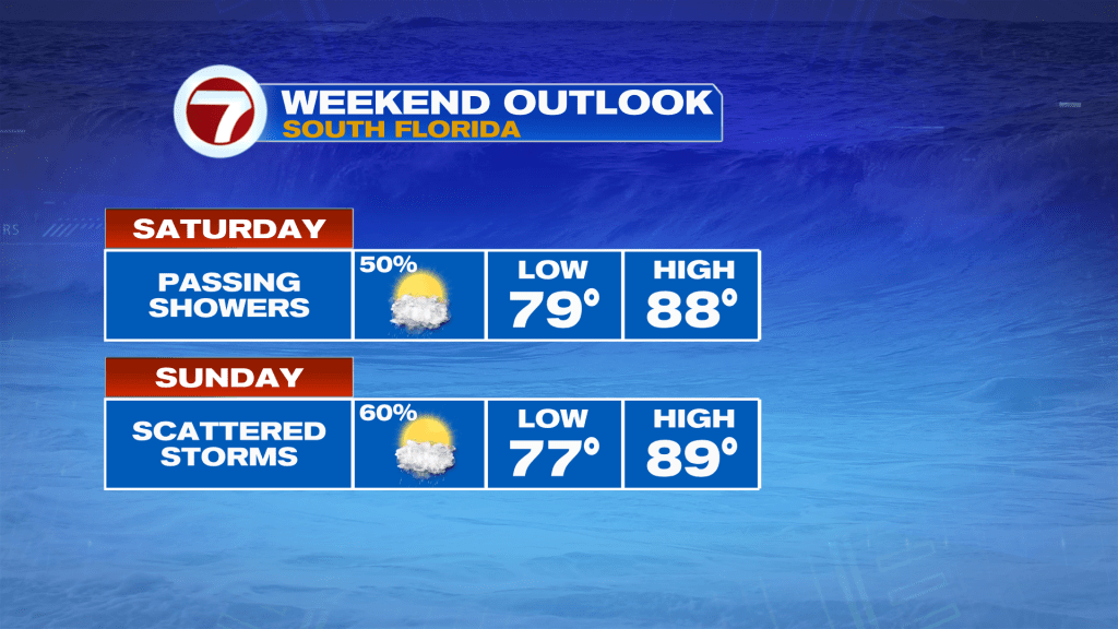
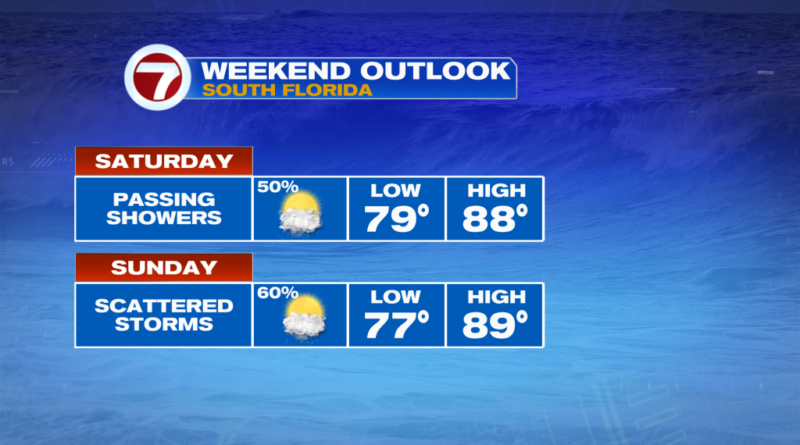
Taking a closer look at the forecast, today looks very similar to Friday. We’ll see a mix of sun & clouds with highs in the upper 80s. A steady beach breeze will make it feel a bit nicer though. The issue is we’ll see the occasional shower off the Atlantic in the morning, with a higher chance in the afternoon with daytime heating.
Sunday could be a bit wetter with much more moisture across the area. That will once again keep our highs in the 80s with a mix of clouds & sun.
Looking ahead to next week, we still look to be stuck in this pattern with the same pesky stalled front over the sunshine state.
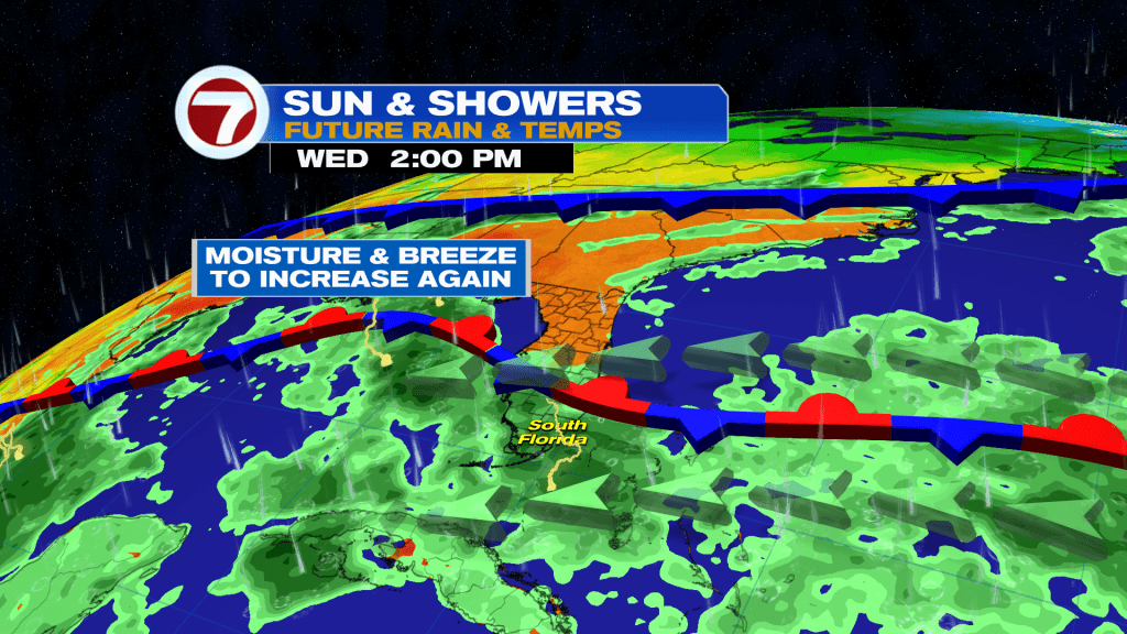
That means shower and storms will stay in the forecast with highs in the 80s and lows in the 70s. There are some hints of a fall front clearing out rain chances heading into next weekend. Stay tuned!
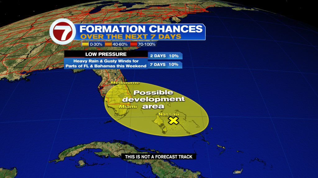
Tropical update
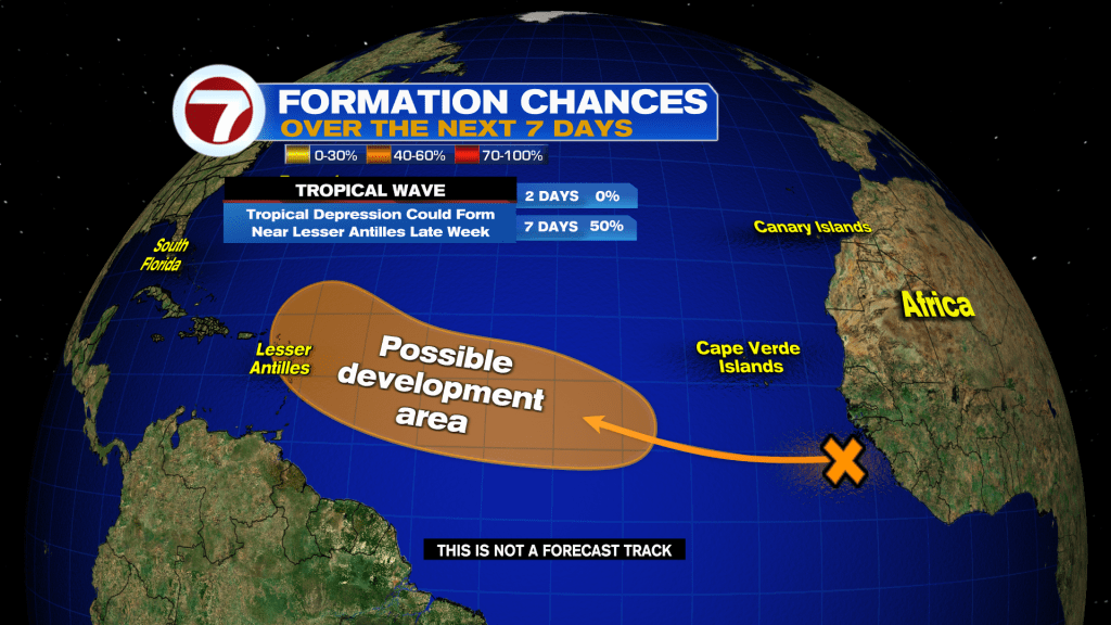
There are currently no active systems in the tropics but there are still two areas the National Hurricane Center is monitoring for potential tropical development.
That includes an area of low pressure that has formed over the central Bahamas that has a low, 10% chance of forming as it travels northwest toward central Florida. This low is forecast to track near or over Florida by the end of the weekend, aiding in the wet and gusty weather pattern.
Farther east, there’s a tropical wave moving off from Africa with a medium, 50% chance of developing within the next 7 days. The Lesser Antilles should monitor for possible impacts by around next weekend depending on this potential system’s future track.