SOFLO ON A ROLLERCOASTER RIDE – WSVN 7News | Miami News, Weather, Sports
Happy Saturday, January17, 2026, South Florida!
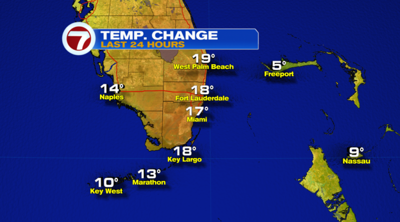
Hopefully everyone has had a chance to thaw out from the chilly temperatures we endured on Friday. Behind Thursday’s front, temperatures across all of South Florida dropped into the 40s and 50s with wind chill values as low as the 30s for some inland locations. And after a cool Friday afternoon, our winds turned out off the water and allowed for milder ocean air to gradually move in. This was evident this morning as our temperatures were not nearly as cold as they were on Friday morning. In fact, temperatures were up to 15-20° warmer this morning compared to yesterday. Even then, South Florida had a very comfortable start to the day with temperatures mostly in the 60s with a few inland 50s across Miami-Dade & Broward.

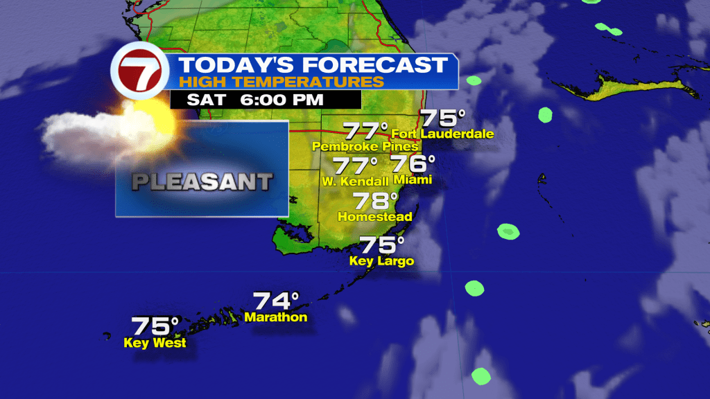
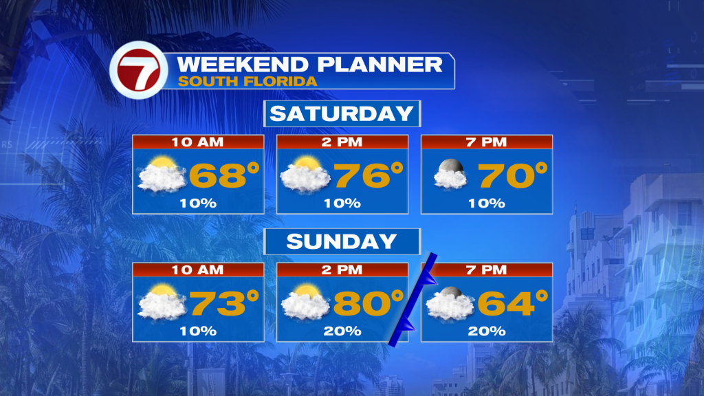
If you don’t like the cold weather, then today will be a big step up from what we experienced on Friday. A change in the wind direction will make all the difference and allow our afternoon high temperatures to reach into the mid 70s. However, it all comes at a cost. With the return of ocean air comes milder temperatures but it also brings more cloud cover and that’s exactly what we can expect today. While South Florida will enjoy peeks of sunshine, there will be cloudy periods from time to time. A passing sprinkle or spotty shower cannot be ruled out.
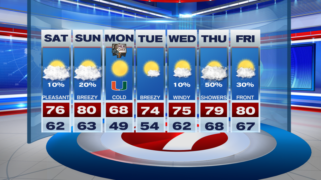
Looking ahead to the latter part of the weekend, our temperatures will continue to climb with most areas reaching into the upper 70s on Sunday afternoon. Some spots may even reach that 80° mark. The reason? Warmer winds returned to South Florida on Sunday as another front approaches the region. And while limited moisture will accompany this front, a shower or two cannot be rolled out.
If a day of cold weather was not enough for you this time of round, then you’re in luck, because Sunday’s front will bring another chill in the air across South Florida by Monday morning. This means temperatures will drop once again to the 40s and 50s to start the new week. We will even get to enjoy a bit more sunshine behind the front. The cold weather event will once again be short-lived because our winds will immediately veer off the water and allow our temperatures to climb again. At times you’ll notice breezy conditions throughout the week. But even more noticeable will be our temperatures warming a little more each day than the day before and by the middle to end of the week, showers will return to the forecast once again as another front moves into the region.
Have a wonderful weekend!
Erika Delgado
Meteorologist
WSVN / ABC Miami
Copyright 2025 Sunbeam Television Corp. All rights reserved. This material may not be published, broadcast, rewritten or redistributed.