Afternoon Storms Rest of Week While Watching the Tropics – WSVN 7News | Miami News, Weather, Sports
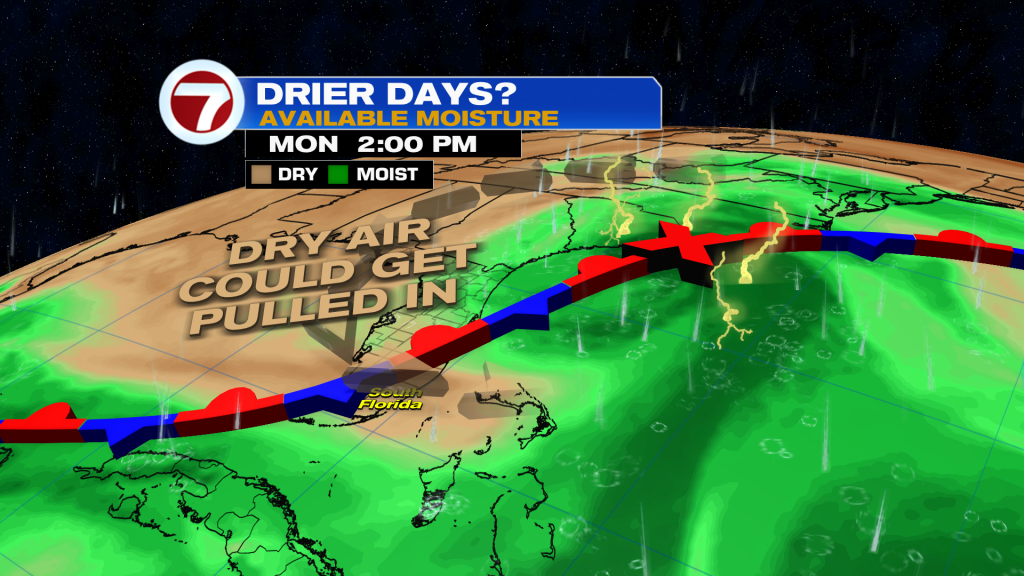
It will be a rinse and repeat weather pattern the rest of this week and potentially into the weekend depending on when drier air arrives. That dry air timing will be associated with a front and Invest 94L — the area of disturbed weather in the tropics that is likely to develop soon.

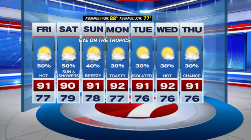
In South Florida for the rest of our Thursday, expect scattered showers and storms with isolated areas of flooding. Activity should diminish for the most part by late tonight, giving way to mostly clear skies.
Friday is projected to be quite similar as well with steamy morning sunshine giving way to hit-or-miss showers and storms over the course of the afternoon. High temperatures will be in the low 90s for most locations with a 50% rain chance.
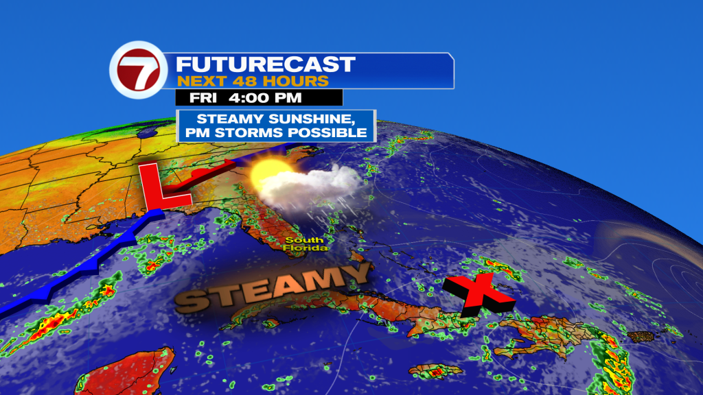
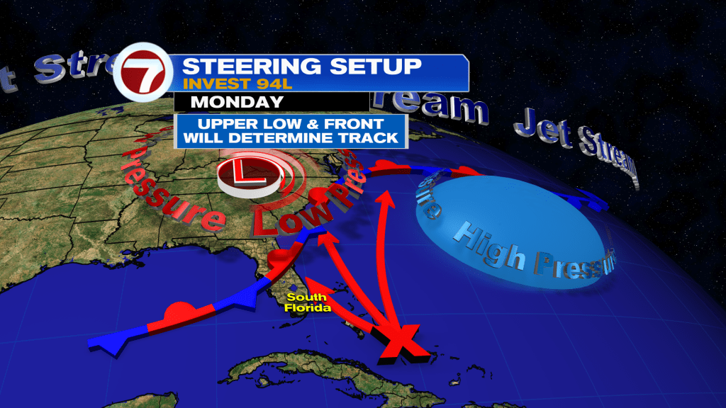
The forecast over the weekend then becomes a bit more uncertain as it will have a lot to do with Invest 94L and the factors that will influence that disturbance’s future track. Essentially, 94L will try to drag in drier air into Florida as it travels north.
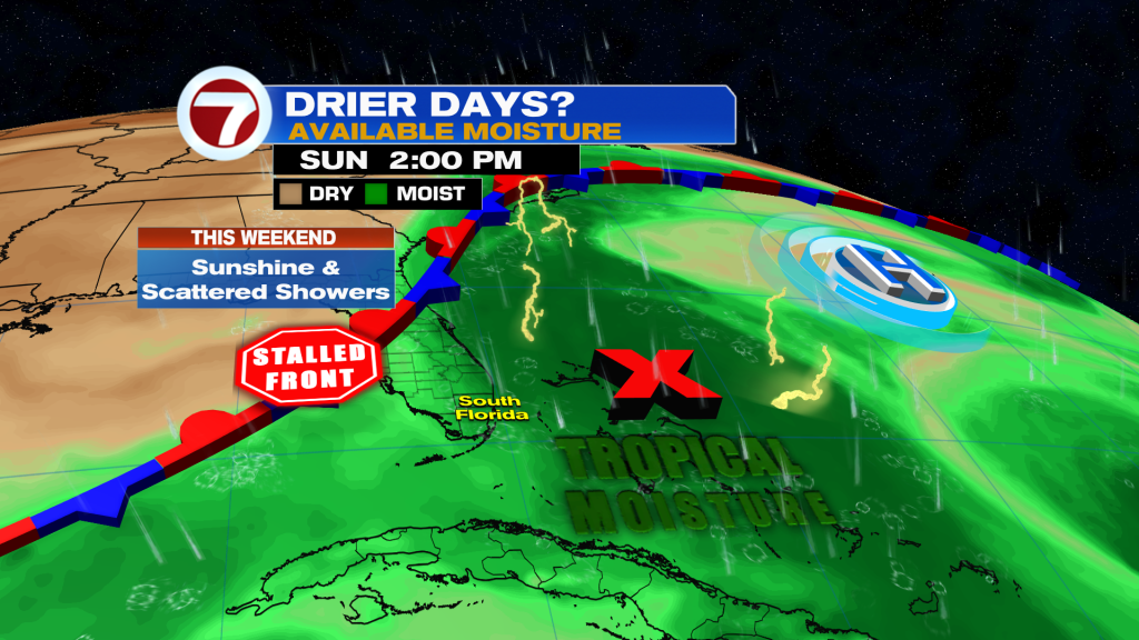
Given the latest guidance, the dry air won’t fully settle in until early next week, meaning times of scattered showers and isolated storms are possible for the weekend. Otherwise, there will still be sunshine and some dry time, especially in the mornings, while highs top off into the low 90s.
Tropical update
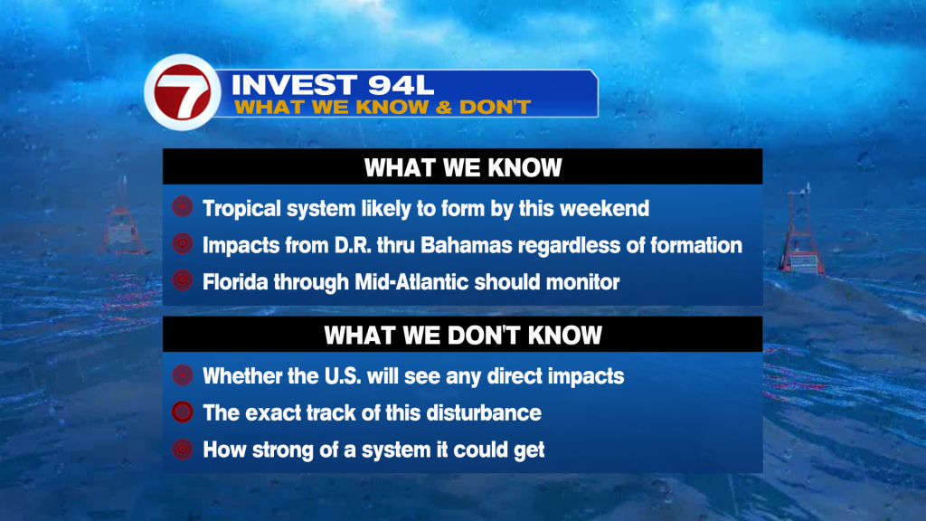
The majority of our attention in the tropics is currently delegated to Invest 94L considering it’s the closest to the US and could directly impact parts of the country.
With that said, there are also Hurricane Gabrielle, which will impact the Azores Thursday night into Friday morning, and Tropical Storm Humberto, which is set to become a hurricane over the southwest Atlantic over the weekend while remaining over the open waters of the Atlantic. At this time, Humberto is not a worry for the US.
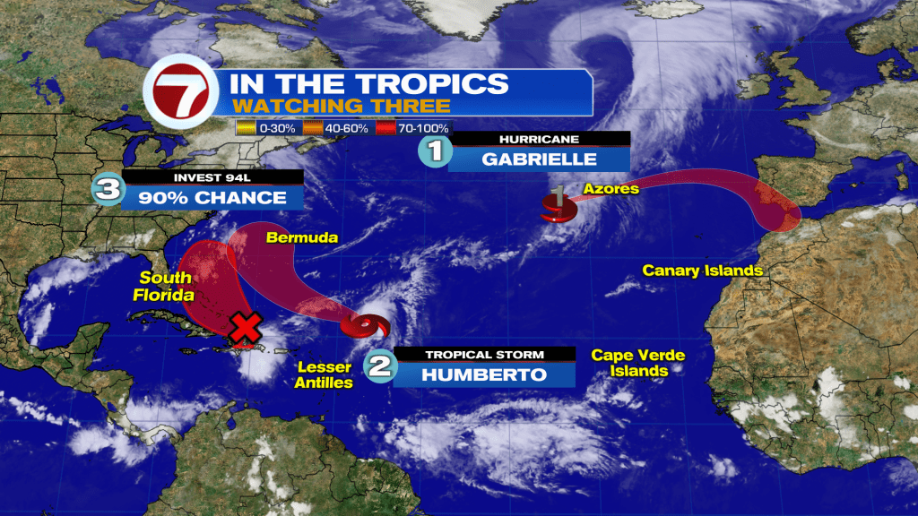
As of 2PM Thursday, 94L has a high chance of forming in the red-shaded region, meaning it could form near or over Turks and Caicos or the Bahamas.
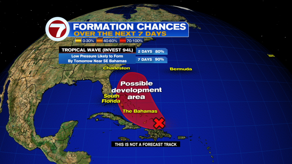
Over the weekend, it will likely be a tropical depression or storm somewhere over the Bahamas. While most of the model guidance keeps this potential system east of South Florida, it remains close enough that we should still monitor these next few days, especially because this disturbance is not yet developed.
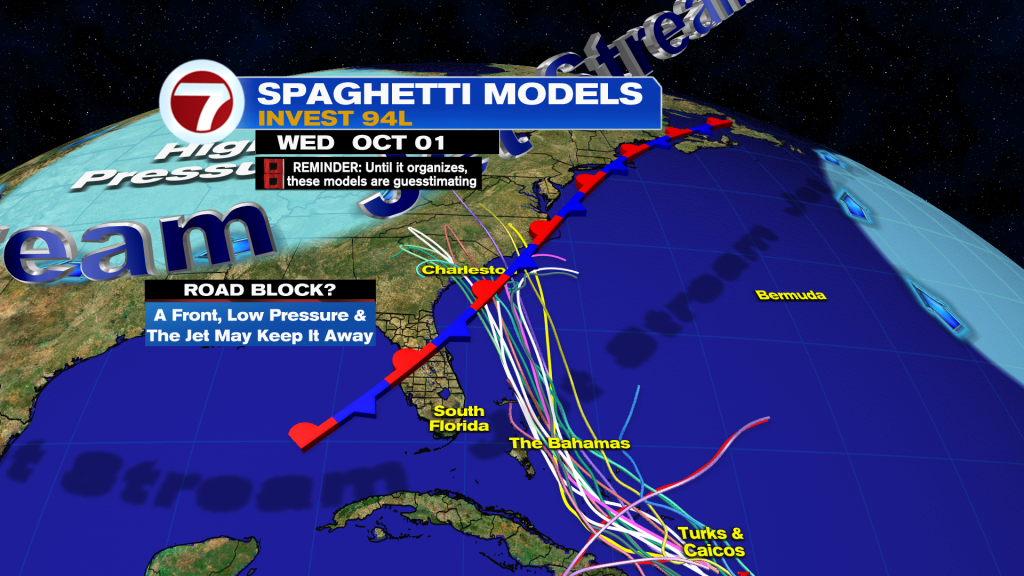
Then by early next week, an upper-level low over the eastern US could draw this tropical entity toward the Southeast US. The model guidance throughout today has suggested that a landfall somewhere in the Carolinas is a real possibility but again, this exact forecast is still not set in stone.
Therefore, here’s what we know and what we don’t know at this time: