Cold Weather Advisory in effect Friday Morning – WSVN 7News | Miami News, Weather, Sports
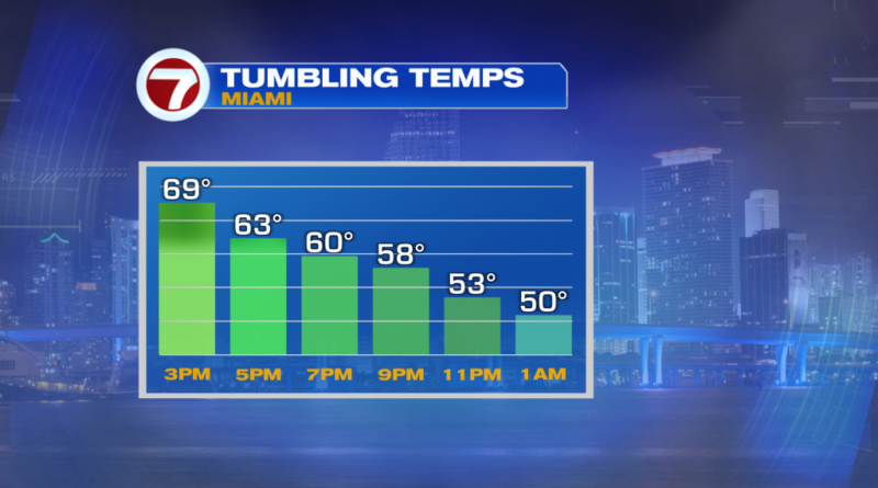
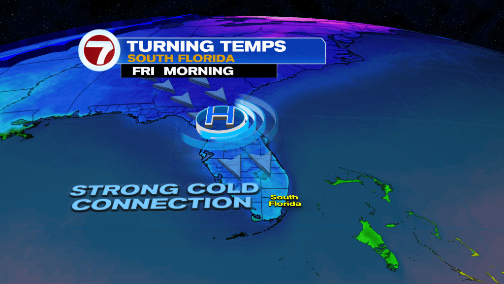
The cold front we’ve been waiting for throughout this week is finally here! It crossed through midday Thursday and is unleashing a blast of cold temperatures for Thursday night into Friday.
For the rest of our Thursday, expect windy conditions, mostly cloudy skies and falling temperatures. Winds will gust up to 30-40 mph at times, then will gradually decrease overnight tonight.

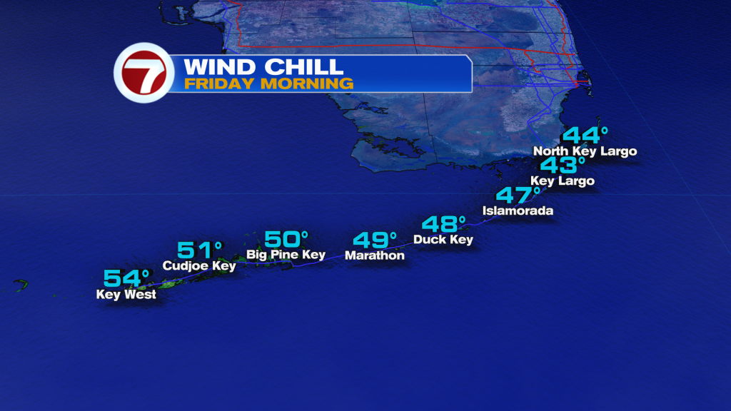
Given the breeze still present tonight, however, that will introduce a wind chill with widespread feels-like temperatures getting down to the upper 30s for many locations in South Florida.
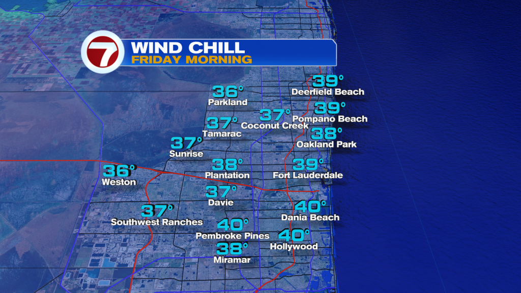
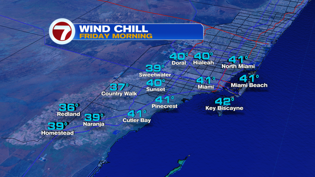
As a result, the National Weather Service has issued a Cold Weather Advisory for metro and inland Miami-Dade and Broward Counties from 3AM-9AM Friday for forecast wind chills as low as 30F.
Actual lows will be a few degrees milder with lows for most areas reaching the low to mid 40s.
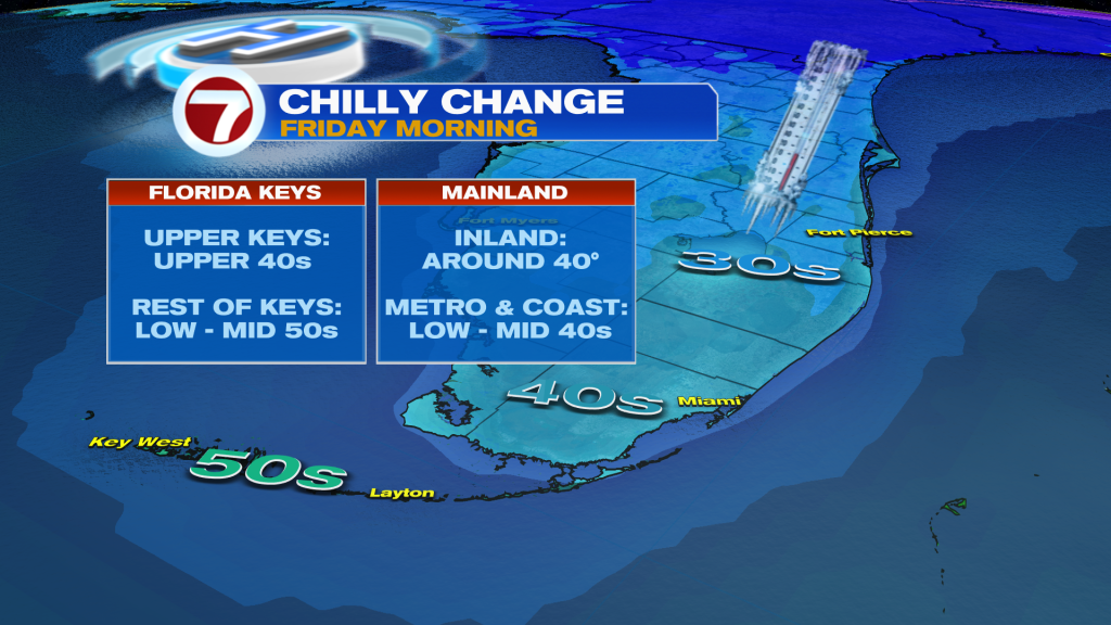
During the day Friday, a northerly wind will be in place all day long, locking in the cold. Highs will only reach the upper 60s, which is about 10F below average. At least the wind will be lighter and the sun will be out an shining!
Clouds then return during the day Saturday as some moisture tries to stream up the coast. Saturday will still be a fairly cool day overall, just not as chilly as Friday.
By Sunday, we’ll start off cool then end warmer with highs flirting with 80F ahead of our next cold front.
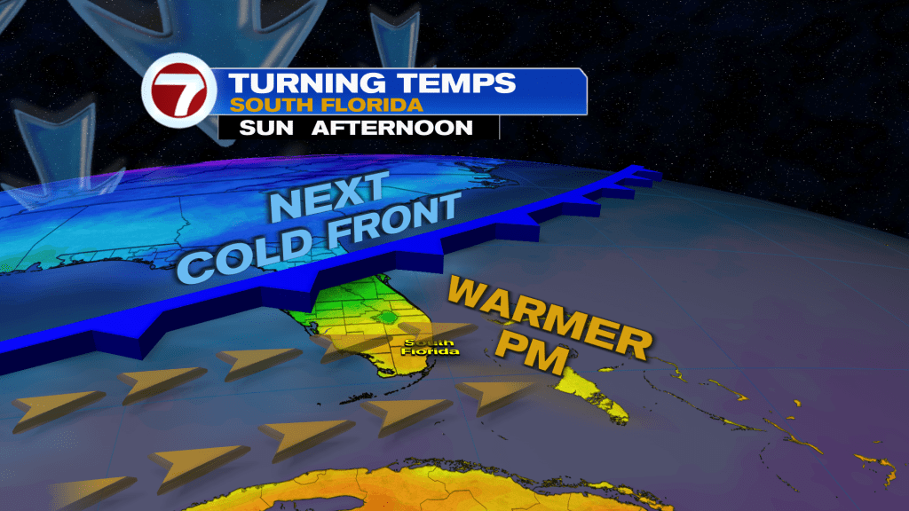
That cold front brings in another drop in temperatures for early next week, making for perfect football weather for the National Championship Monday evening.