Fall Front Arrives This Weekend – WSVN 7News | Miami News, Weather, Sports
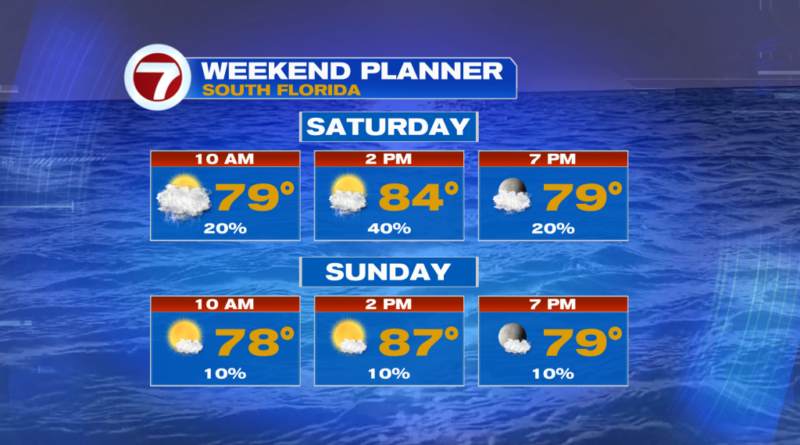
It’s going to be a tale of two different forecasts this weekend as we wait for the arrival of our first Fall Front here in South Florida.
For today, we’re going to deal with lingering clouds and storm chances across South Florida. The highest chances will be south in the Keys, but any storms that develop will bring the threat of heavy rain, lightning, and gusty winds. The extra clouds will keep highs in the mid-80s. We’ll finally see things clear up tonight.
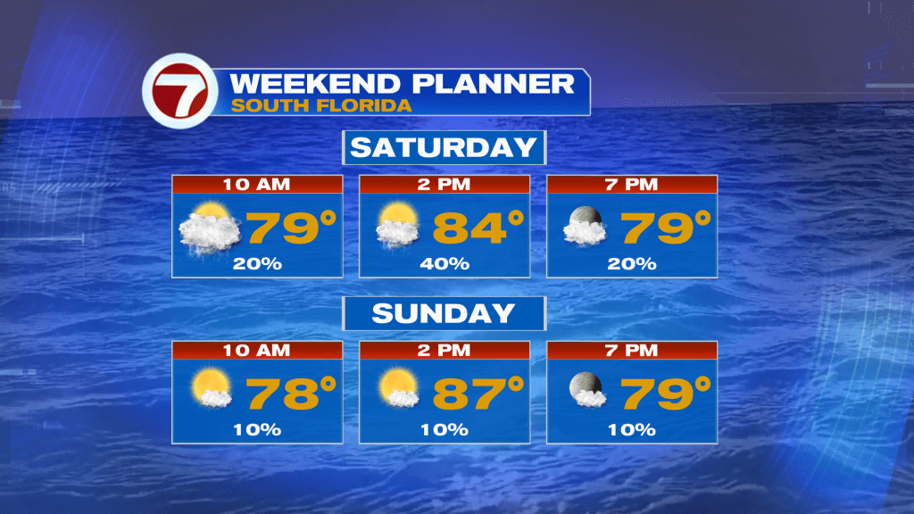
Sunday looks a lot nicer as the Fall Front pushes south of us. It will feel amazing, especially in the morning as slightly lower humidity moves in from the north. Expect lots of sun with highs in the mid-80s.
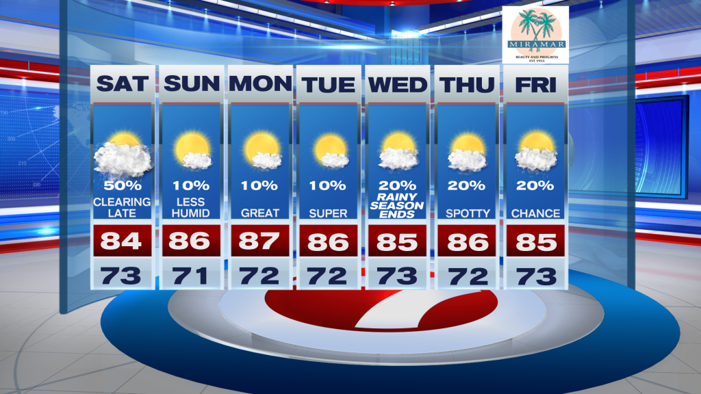
Looking ahead to next week, rain chances stay low with highs in the mid-80s and lows in the 70s. Rainy Season officially ends on Wednesday.
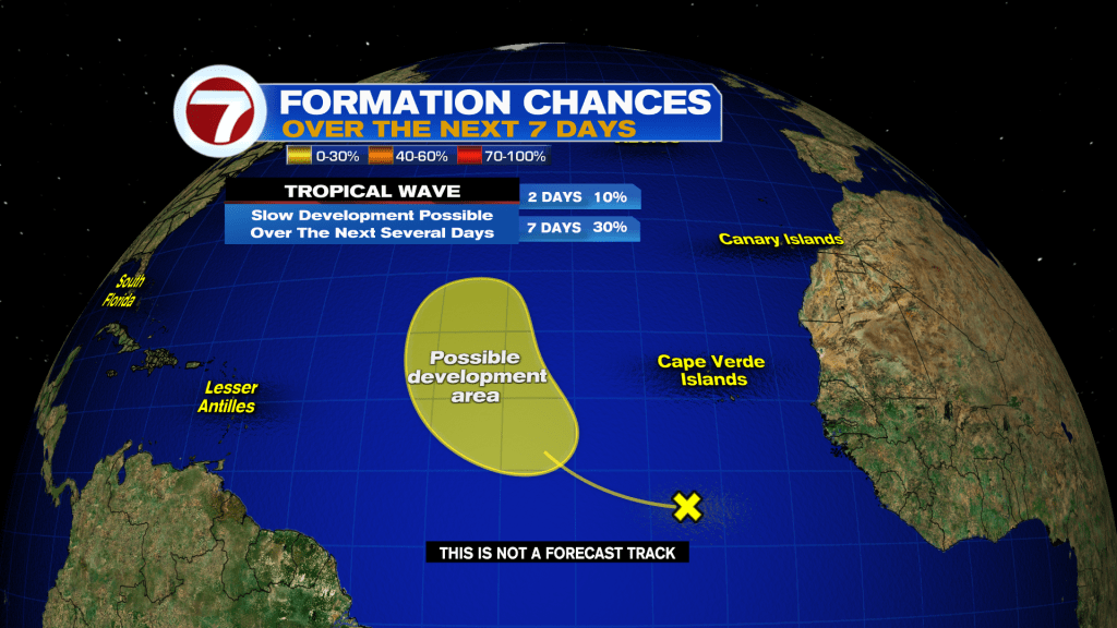
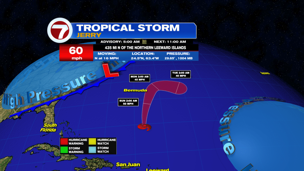
Tropical Update
Karen is already gone, and that just leaves us with Jerry at the moment.
Jerry remains a tropical storm with 60 mph winds this morning. Jerry is forecast to stay well east of Bermuda and is forecast to dissipate by Monday.
Meanwhile, another tropical wave has a low chance of development in the eastern Atlantic over the next seven days. Next name on the list is Lorenzo.