Gabrielle becomes a hurricane in Atlantic waters southeast of Bermuda – WSVN 7News | Miami News, Weather, Sports
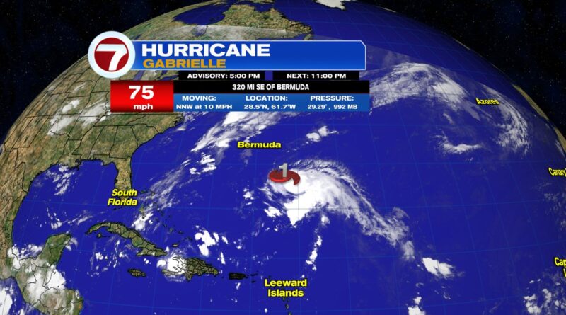
MIAMI (AP) — Tropical Storm Gabrielle strengthened into a hurricane Sunday afternoon southeast of Bermuda in the Atlantic Ocean, forecasters say.
The Miami-based National Hurricane Center said Gabrielle’s maximum sustained winds increased to 75 mph (120 kph), making it a Category 1 hurricane.
Gabrielle was located about 320 miles (515 kilometers) southeast of Bermuda and moving to the north-northwest at 10 mph (17 kph).
THIS IS A BREAKING NEWS UPDATE. AP’s earlier story follows below.
Tropical Storm Gabrielle strengthened in Atlantic waters southeast of Bermuda on Sunday and was close to becoming a hurricane, forecasters said.
Gabrielle had maximum sustained winds of 65 mph (100 kph) and was less than 10 mph (16 kph) shy of hurricane strength as meteorologists warned the storm could rapidly intensify in coming hours.
The storm was centered Sunday afternoon about 390 miles (630 kilometers) southeast of Bermuda and was moving to the northwest at 12 mph (19 kph), the National Hurricane Center in Miami said. It said rapid strengthening could come over the next day or two.
On the current forecast track, Gabrielle was expected to pass east of Bermuda on Monday. No coastal watches or warnings are in effect, but meteorologists urged interests in Bermuda to keep a close watch on the storm’s progress.
The hurricane center said large ocean swells kicked up by Gabrielle are impacting Bermuda and are expected to reach the Eastern Seaboard from North Carolina northward into Atlantic Canada over the coming days.
Copyright 2025 The Associated Press. All rights reserved. This material may not be published, broadcast, rewritten or redistributed.

