Storms Likely Rest of Holiday Weekend – WSVN 7News | Miami News, Weather, Sports
Following sunshine and some storms on Saturday, more activity is in store for South Florida the rest of this Labor Day weekend.
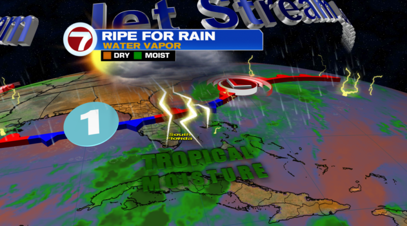
A bit of drier air actually helped prevent widespread storms from organizing Saturday afternoon but moisture levels do continue to increase going forward courtesy of a nearby, stalled front. Therefore, storms are likely at some points both Saturday and Sunday.

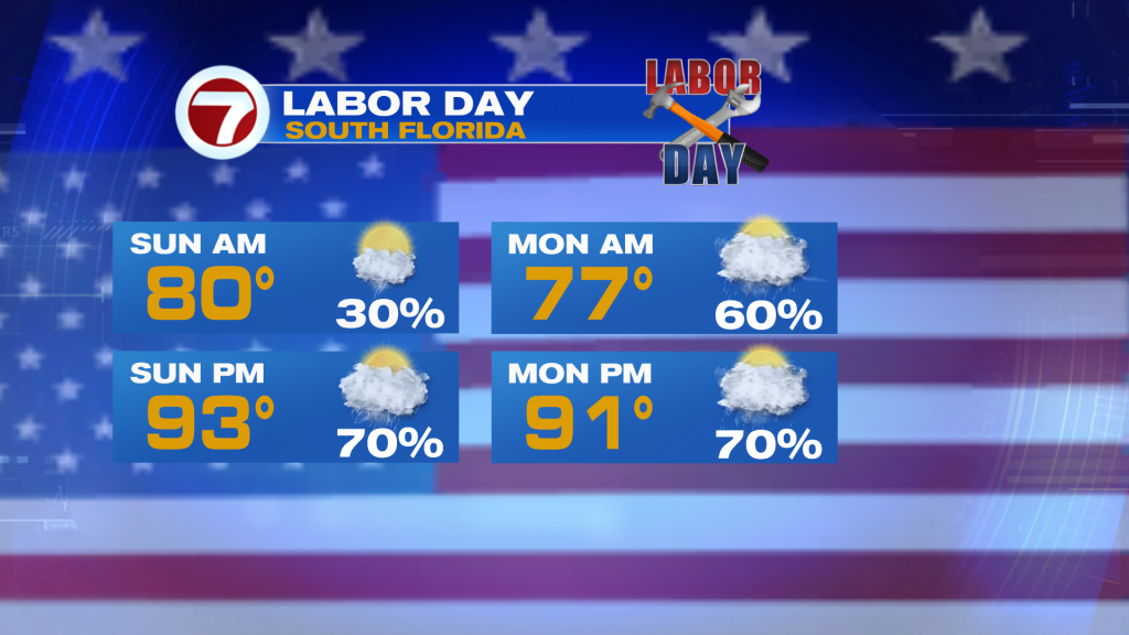
For sunshine, expect steamy morning sunshine, allowing for highs to surge into the low to mid 90s. A couple showers and storms will be possible, especially near the Keys and coast.
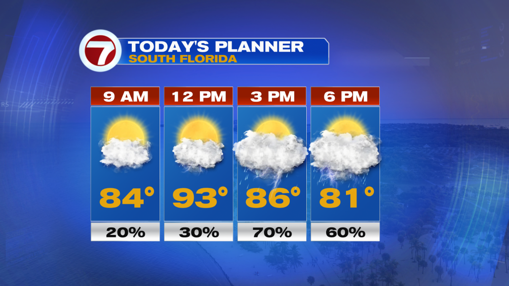
Then as the afternoon progresses, numerous to widespread thunderstorms are likely, some of which will be strong and heavy. That means gusty winds and flooding will be possible across some communities later today, especially depending on how slow the storms move.
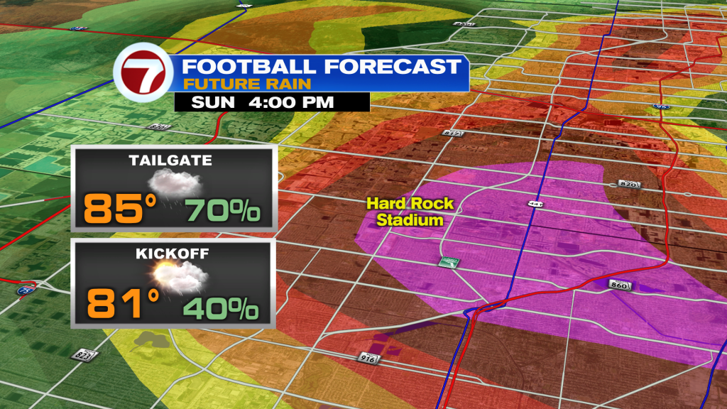
By this evening for the big season opener of the University of Miami hosting Notre Dame, conditions should dry out around kickoff. With that said, lingering showers and storms will be possible across the area. Even if it’s dry over the stadium, nearby storms could pose the risk for a lightning delay.
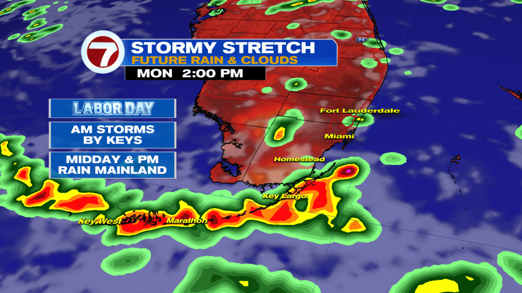
By Labor Day of Monday, not much changes with this overall stormy setup. The front will still be nearby, although storms on Monday will have an earlier start. It won’t be a washout but rounds of showers and storms seem like a good bet at any point in the day Monday.
Then for the rest of next week, the stormy and unsettled pattern will persist as a second front emerges from the north and west. With moisture in place and a westerly steering flow, that will keep rounds of showers and storms in the forecast, especially during the afternoon hours.
Tropical update
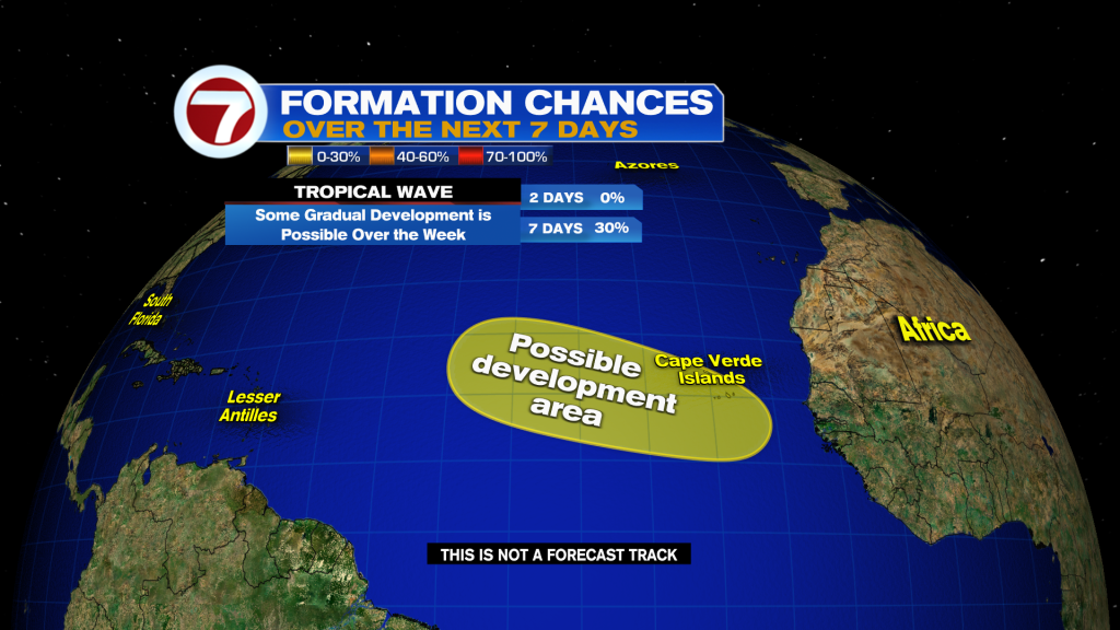
Still following one area in the Atlantic basin for tropical development. It’s a tropical wave over Africa that has a low formation chance over the next week as travels west. For the US, there are no tropical concerns at this time.