Sun and Storms this Weekend – WSVN 7News | Miami News, Weather, Sports
The unsettled weather pattern unfortunately continues into this weekend but it won’t be raining all weekend long.
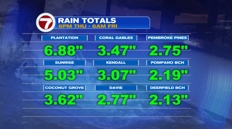
This comes on the heels of what was a wet and stormy Thursday night across parts of South Florida when some locations received more than 3-6 inches of rainfall, which led to some flooding.

The flood threat will remain elevated Friday afternoon into Friday night when scattered to potentially numerous, passing showers and storms are forecast at times. Rainfall amounts in isolated locations could amount to several inches once again.
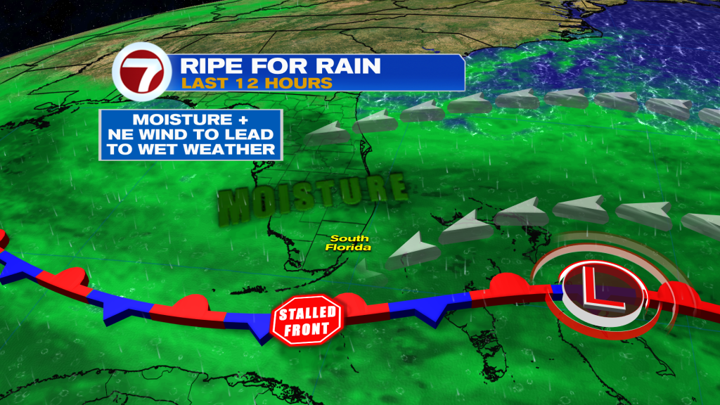
The reason for this soggy pattern is a front stalled out near South Florida. That is trapping moisture while a robust wind out of the northeast will be in place Friday. These ingredients often lead to showery weather conditions.
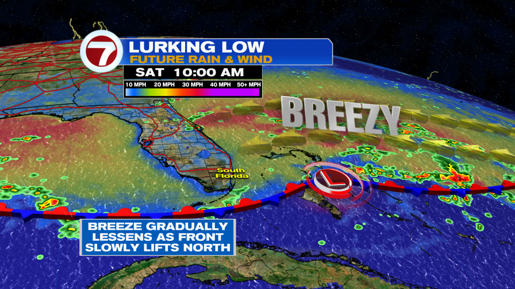
Over the weekend, this front will gradually lift northward, which will allow for the wind to lessen and some drier air to feed in at times. With that said, both Saturday and Sunday will feature the possibility for times of showers and storms. Otherwise, there will still be a decent amount of dry time with the sun coming out, which will drive high temperatures up and into the upper 80s.
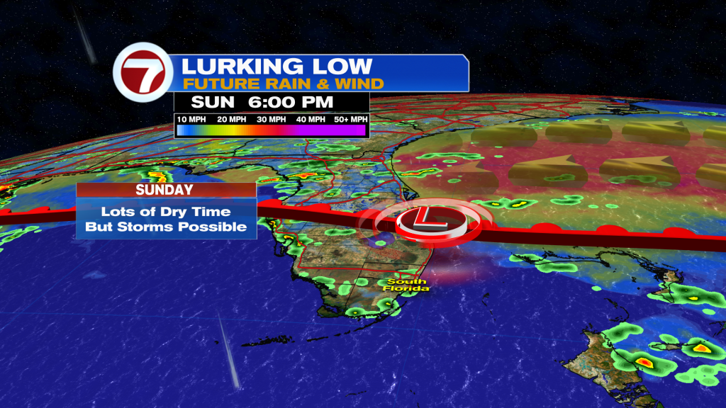
The potential for heavy rainfall will also exist this weekend, so the concern for flooding will still be present.
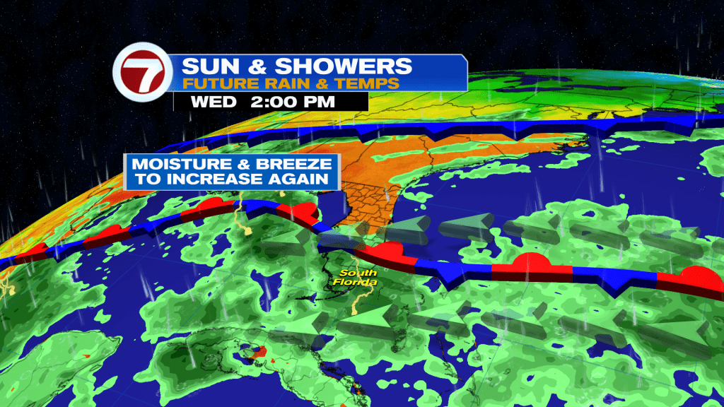
By next week, the front will remain nearby, keeping moisture levels elevated while the breeze is expected to increase once again, especially over the midweek time frame. Therefore, the daily chance for scattered showers and storms will remain in the forecast.
Tropical update
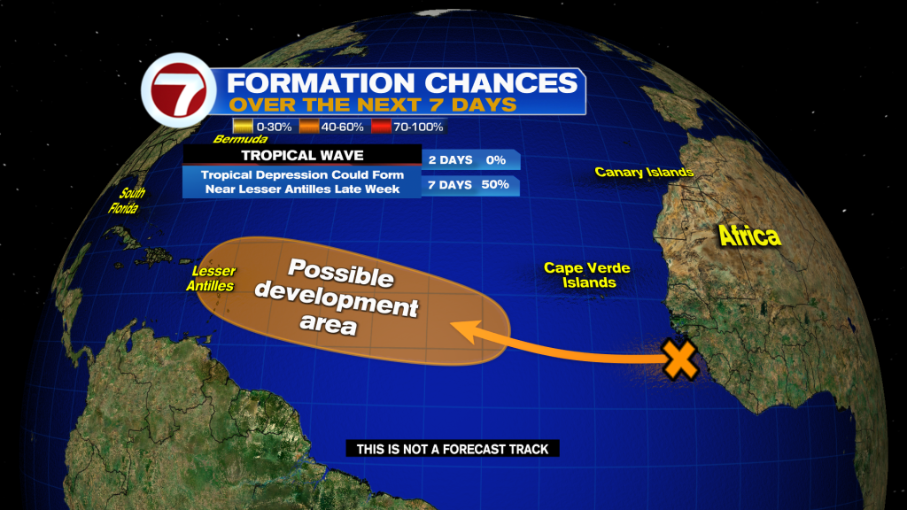
There are currently no active systems in the tropics but there are still two areas the National Hurricane Center is monitoring for potential tropical development.
That includes an area of low pressure that has formed over the central Bahamas that has a low, 10% chance of forming as it travels northwest toward central Florida. This low is forecast to track near or over Florida by the end of the weekend, aiding in the wet and gusty weather pattern.
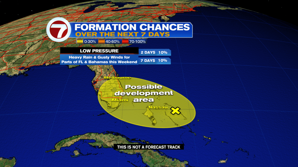
Farther east, there’s a tropical wave moving off from Africa with a medium, 50% chance of developing within the next 7 days. The Lesser Antilles should monitor for possible impacts by around next weekend depending on this potential system’s future track.