Unsettled Week Ahead with Showers Possible Daily – WSVN 7News | Miami News, Weather, Sports
The unsettled stretch of weather will continue into this new week across South Florida but while rain chances will be elevated, a widespread rain is not expected any of the days. Instead, it will be times of passing showers and storms that could add up in some locations.
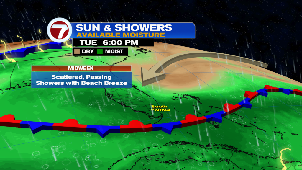
A front remains stalled nearby, and this will help trap moisture, aiding in these rain chances.
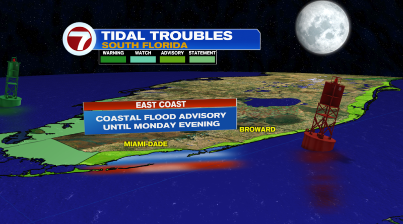
The King Tides are also occurring, with this current cycle projected to feature the highest water levels of the year, due to the Supermoon peaking Monday night. If any downpours coincide with high tide, that will make flooding even worse. A Coastal Flood Advisory is in effect for coastal Miami-Dade and Broward and all of the Florida Keys through at least Monday evening.

For our Sunday, it won’t be a washout by any means but there will be a slightly greater chance for rain versus how it panned out Saturday. Therefore, expect a mix of sun and clouds and spotty showers in the morning followed by increasing clouds and scattered storms, especially inland, for the afternoon. Some of this activity could drift toward the coast in the evening.
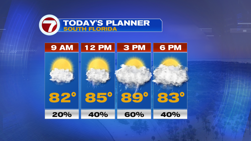
Highs Sunday will generally reach the upper 80s along with a lighter breeze. That breeze will remain fairly light into Monday before ramping back up a but midweek.
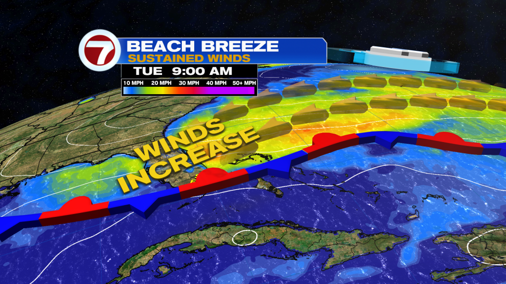
With that front still nearby along with a disturbance riding along it, that will allow for passing showers and storms much of the week. Given the onshore breeze, this will generally favor showers near the coast and metro during the morning hours before gradually shifting inland for the afternoon.
Highs throughout the week will be in the mid to upper 80s.
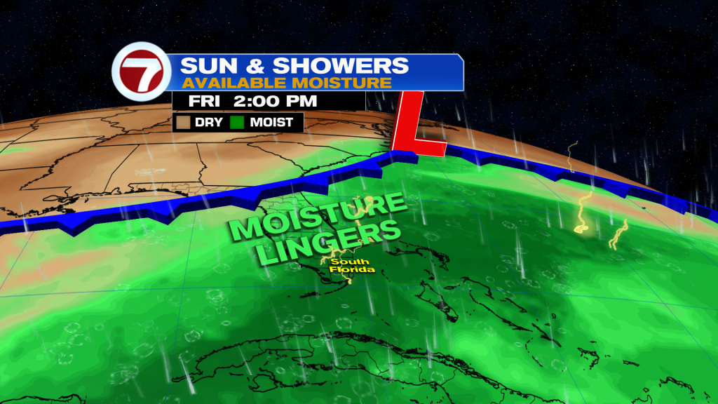
By next week, there is the potential for a front to arrive which could usher in some drier air. It’s still early to know whether this will pan out but rainy season does end in just 10 days, so it’s normal to start seeing signs of lower rain chances showing up in the forecast!
Tropical update
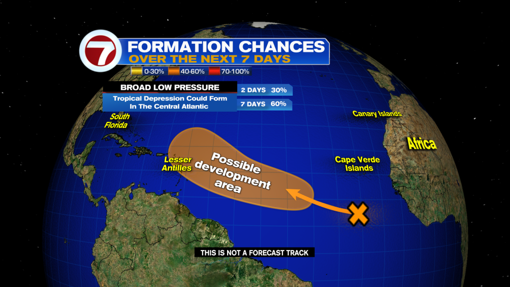
The National Hurricane Center is monitoring one feature in the tropics for potential tropical development. It’s a broad area of low pressure over the eastern Atlantic Ocean, which has a 60% chance of forming within the next 7 days. It will be worth watching for the Leeward Islands over the course of this week.